The Passage Tomb Landscape of County Sligo
Sacred Neolithic Landscape
About
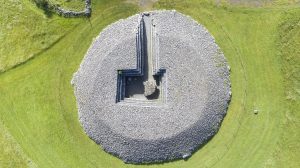
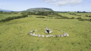
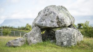
County Sligo possesses approximately one hundred intensely interconnected megalithic passage tomb sites and undisturbed cairns in often dramatic topographical environments.
The Passage Tomb Landscape of County Sligo can be visualised as a northern coastal group of passage tombs centred on the Carrowmore complex and the Cúil Iorra peninsula, and a southern inland group in the Bricklieve Mountains, anchored by the Carrowkeel complex, both areas containing dense concentrations of monuments. These two foci, 23 km apart, are geographically connected by the Unshin River, but also by an intimate and dynamic interaction between landscape, ritual and ancestral connections.
The proposed inscribed Property encompasses 26 units of varying size as a serial property, totalling an area of 16 km2. Today this Neolithic landscape contains remote areas, and hills of varied geology, the whole infused by a rich corpus of medieval Gaelic myth – much of which directly relates to these monuments and places. Many of the monuments are unopened and in an excellent state of preservation.
The passage tomb tradition of County Sligo is characterised by an intense dialogue between monuments and landscape, but also by construction, distribution patterns and longevity of use.
Gallery
Map
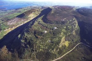
- Cairns Hill, Sligo, Ireland
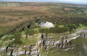
- Knocknarea, Knocknarea South, County Sligo, Ireland
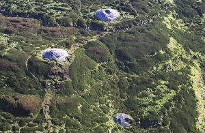
- Carrowkeel Passage Tombs, Carrowkeel, County Sligo, Ireland
- Carrowmore Megalithic Cemetery, Carrowmore, Sligo, Ireland
Potential Outstanding Universal Value
Justification
Neolithic monumentality on the western Atlantic seaboard is an expression of an extraordinary cultural efflorescence following the onset of agriculture. The passage tomb landscape – on which this proposed Property is based – represents the most westerly and dramatic expressions of a remarkable flourishing of the construction of ritual monuments across Europe between five and six millennia ago. The selection of significant topographical locations, often with a high degree of visibility, created a strong intervisibility between the monuments. The various monuments within this extensive landscape thereby all contribute as part of an intricate web of connections. This interconnectivity of monuments and varied local topographies is a potent expression of a long disappeared cultural milieu, which fostered an intense and enduring dialogue between architecture and landscape that remains unmatched in world terms.
The passage tombs of Co. Sligo have a distinctive place within the Irish passage tomb tradition as it is the only area where the full range of monument constructions is clearly represented; from the earliest small boulder circle monuments to the vast cairn covered monuments.
This cultural landscape has an extraordinary density of undisturbed and unexcavated megalithic sites of the passage tomb tradition, providing an unrivalled exemplar of a Neolithic ritual landscape with an exceptional level of completeness, thus illuminating a significant stage in human history.
The monuments were consciously and actively merged with the physical topography in which they are located, and crucially, they remain so; the lives and consciousness of the modern residents of County Sligo daily permeated by living beneath and among these time-honoured monuments and landscapes.
Criterion (iii):As one of the best preserved and densest prehistoric monumental landscapes in Europe, the passage tombs of Sligo bear exceptional testimony to the worldview and ‘sacred geography’ of Neolithic people, notably their ability to use architecture to transform and connect a large geographical area in accordance with their religious beliefs and sentiments.
Criterion (iv):The passage tomb landscape of Sligo demonstrates, in an outstanding way, the creation and development of a Neolithic sacred landscape over a millennium.
Authenticity and Integrity
The Passage Tomb Landscape of County Sligo is a serial site and a cultural landscape. It is comprised of approximately 100 monuments (the attributes) distributed across 26 individual property units covering a total area of 16 km2. The monuments and their landscapes represent a holistic representation of the Neolithic passage tomb tradition through preserving a diverse range of monuments and morphological features in terms of complexity, size and landscape integration.
The state of preservation of the site is unparalleled for a prehistoric cultural landscape of this scale and complexity in northwest Europe. A recent analysis of the site’s monuments demonstrates exceptionally high levels of authenticity. The wide range of monuments within the site represent a cross-section of the distinctive morphological features that characterise the Irish passage tomb tradition with regards to chamber constructions, surrounding cairns and boulder circles and megalithic art. Many of these features are highly probable to be early or foundational examples nationally.
The landscape setting of the monuments and the line of sight between the sites is largely intact, thus maintaining the intrinsic relation between landscape and monument, as well as demonstrating the cohesiveness of this site.
The site is of adequate size to ensure the complete representation of the features and processes which convey its significance. The monuments and their landscape setting are predominately in good condition and are afforded statutory protection both at national and local level.